When travel plans are made, some people love to be around other tourists. They can’t wait to be on a cruise full of locals and talk about their hometowns. They have the time of their lives checking off boxes to see all of the busy, popular landmarks and mingle in large groups. Then, there are other types of travelers. These are the people who want to be as far away from tourists (and even other locals) as possible. They don’t mind being away from civilization. They want to know more about the history of the place they’re visiting. They would fit in comfortably in the most remote places in the world where it’s often quieter and far less of a chance of tourist syndrome. Here are seven of those suggested locations.
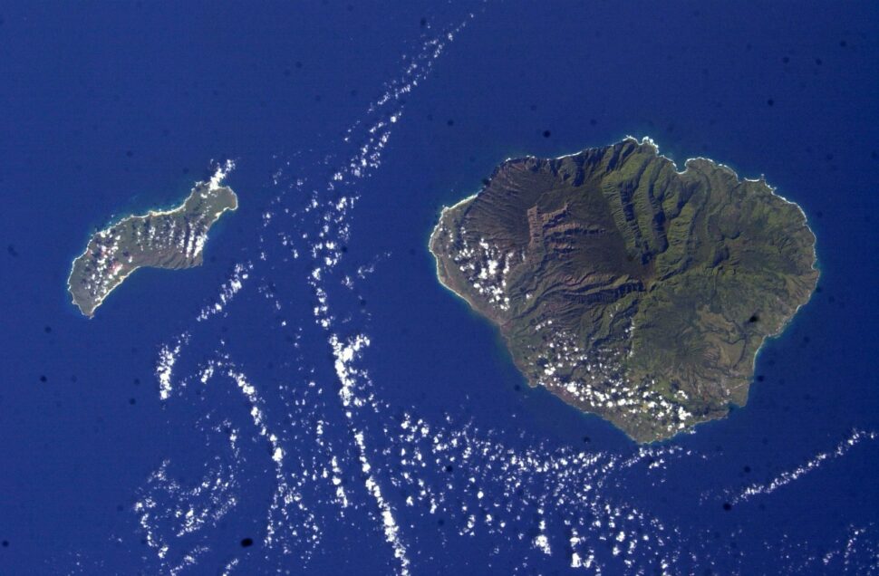
Ni’ihau, The Forbidden Island
Originally purchased in 1863, King Kamehameha IV sold the smallest island for $10,000 to Elizabeth Sinclair of Scotland. Her descendants, the Kamaaina (meaning “old timer”) Robinson family, have been in Ni’ihau ever since. Tourism is prohibited, and the population is solely Hawaiians (in origin and language). Although Olelo Hawaii is the primary language there, the island has its own dialect called Olelo Kanaka Ni’ihau spoken within the community too. In 1959, when an offer of statehood was an option, the consensus rejected the idea. The Robinsons did bend a little on the tourism end. By 1987, the family allowed half-day helicopter tours of Ni’ihau at $440 and a few hours on the beach. However, visitors aren’t allowed contact with the village and communicating with the inhabitants is strictly forbidden.
On the actual island, there are approximately 70 residential families that live in a place with no paved roads, no hospitals, no police stations, no grocery stores nor indoor plumbing. Rainwater is their go-to for bathing, beverages and gardening. Electricity for these families is reliant on solar panels. Food is collected by farming, fishing and hunting. Because of the secluded way Ni’ihau is run, where animals can (reasonably) live in peace without the threat of their homes being torn down as malls or vacation homes, endangered or vulnerable species gravitate to and survive in Ni’ihau.
Angie Corbett-Kuiper
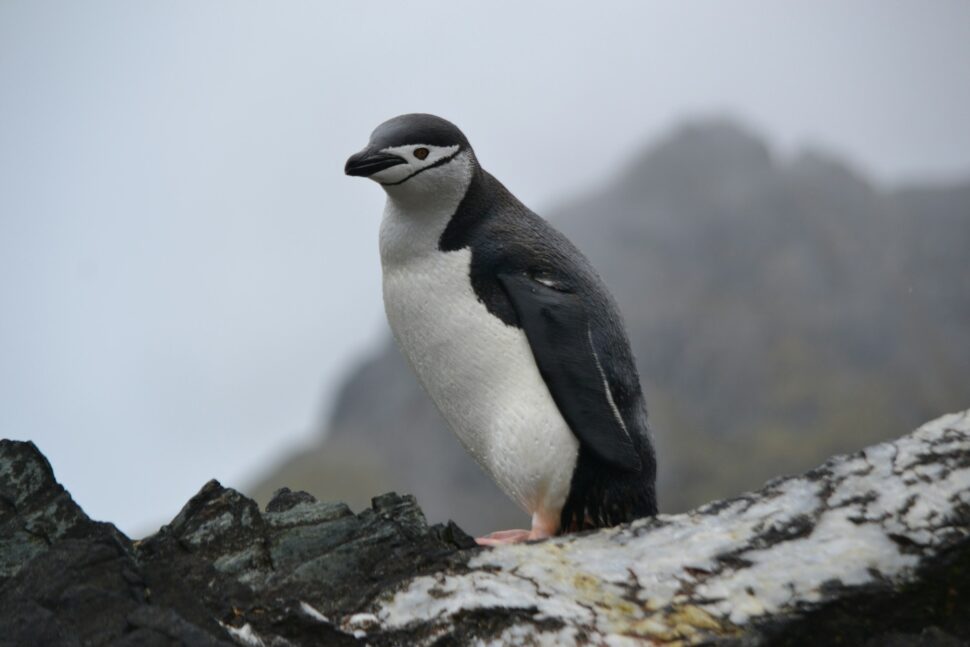
Bouvet Island
For fans of the film Alien vs. Predator, Bouvet Island may look familiar. (The film was not physically shot there though, but the movie set appeared like the actual Bouvet Island.) There are also books about the island, including Frederick Davis’ History of Bouvet Island, a Lecture: The Secret of Bouvet Island and Bjarne Aagaard’s The “Norvegia” Expedition and Bouvet Island. Early discoverers of Bouvet Island include French Commander Jean-Baptiste Charles Bouvet de Lozier in January 1, 1739. Then, British whaler James Lindsay saw it in 1808. Only 7% of the island is not covered by a glacier. The center of Bouvet Island (named by Norway in 1930) has an inactive volcano filled with ice.
Although people aren’t banned from visiting, it’s not a popular place to visit. There was an abandoned lifeboat found in April 1964 that could’ve easily given the passengers access, but no human life was ever found on the far southern side of the Mid-Atlantic Ridge where the island was located. Nyroysa is where people would have access to step onto the island free of ice. Upon entry, initial observations will be boulders, gravel and lava stone. The field station that was there from 1996 to 2006 is long gone after an earthquake. But Bouvet Island is a particularly familiar hangout for chinstrap penguins and macaroni penguins.
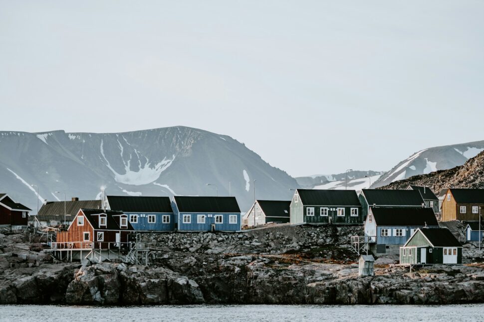
Ittoqqortoormiit
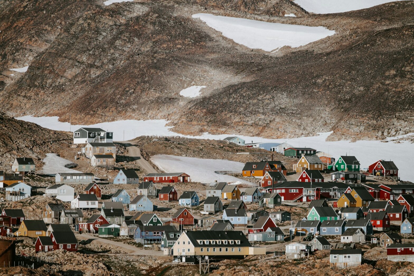
Described as “the most remote inhabited community in the western hemisphere,” Ittoqqortoormiit is a 370-person village with homes sandwiched between the world’s largest national park (Northeast Greenland National Park) in the north and the world’s largest fjord system (the Scoresby Sund) to the south. With no roads in the hunting-and-fishing town founded in 1924 by Ejnar Mikkelsen, there are limited ways to arrive: helicopter, boat (in the summer), snowmobile or one of two weekly flights to Nerlerit Inaat airport. The first flight is from Iceland, and the alternate flight is from West Greenland. Ittoqqortoormiit is filled with a photo-worthy wilderness, along with millions of seabirds nest and enormous icebergs. It is not uncommon to be in Ittoqqortoormiit and see a polar bear.
Although it is generally considered remote, those who visit can enjoy sailing and hiking from July to August; dog sledding, snowmobiling and the Northern Lights from February to May; seal hunting from February to April; and musk-ox hunting from August to October and December. To get from Point A to Point B locally, locals walk because there is no other form of transportation within the town limits.
Hector John Periquin
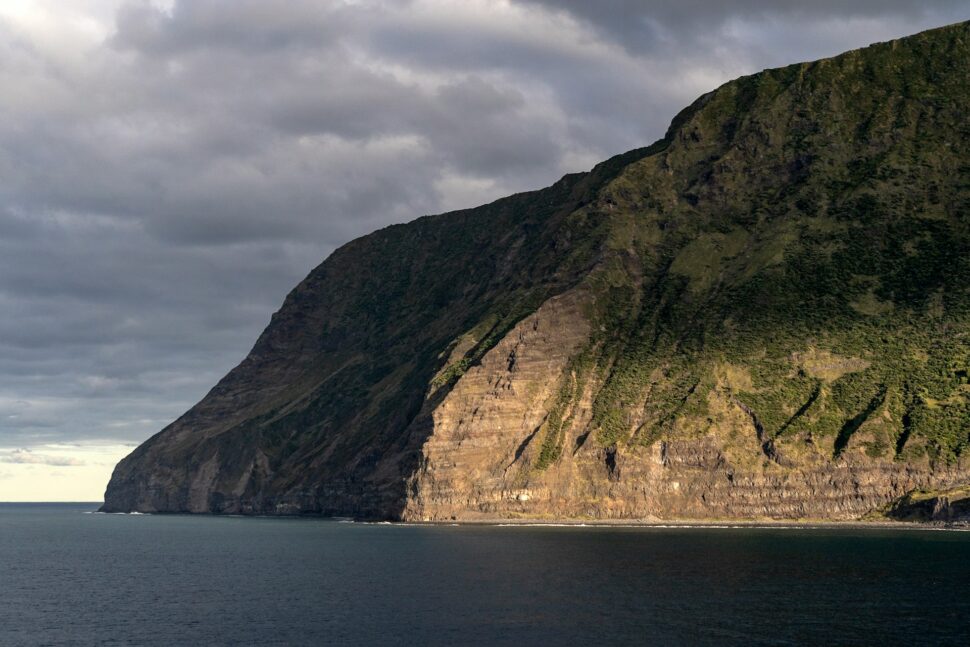
Tristan da Cunha
Overlooked by early explorers due to its rugged mountain landscape, it is absent of natural harbor and agricultural land, along with heavy rain and high winds at all seasons. The first recorded landing was by the crew of the Dutch vessel Heemstede in 1643, who had access to fresh water, fish, seals and penguins. The Dutch mounted two expeditions to Tristan between 1650 and 1669 to explore whether the island could become a supply base for ships. That idea came and went, more than likely due to the rough weather. Then, in the late 18th century, Americans started showing up for whaling and sealing ships. Captain John Patten of Philadelphia used the island as a base during the 1790-91 summer while living in tents and collecting seal oil and 5,600 sealskins.
Jonathon Lambert, from Salem, Massachusetts, led a party of three men in 1810 to establish a trading station on Tristan. With the intention of renaming the land as the “Islands of Refreshment,” this never happened after he drowned during a fishing accident. By the time HMS Seiramis arrived in 1813, Tomasso Corri (alias Thomas Curry from Livorno in Italy) was the only survivor. Corri’s treasure is still explored in several books on Tristan.
Tristan did enjoy an economic boom, boosted by earnings from crawfish royalties, regular fishing and supply boats. In 1955-56, there was a scientific expedition to Gough Island followed by an agreement with the South African government for the latter to maintain a permanent weather station on the island. A condition of the Gough lease was an annual visit to Tristan by a South African ship: first SAS Transvaal and from the 1980s RSA Agulhas. Nowadays, in the small village of Edinburgh, visitors can visit the home of approximately 70 families of farmers. Visitors can become part of the community by renting a guest house (catered or self-catering) or by staying in homes on a full-board basis.
Devon Island
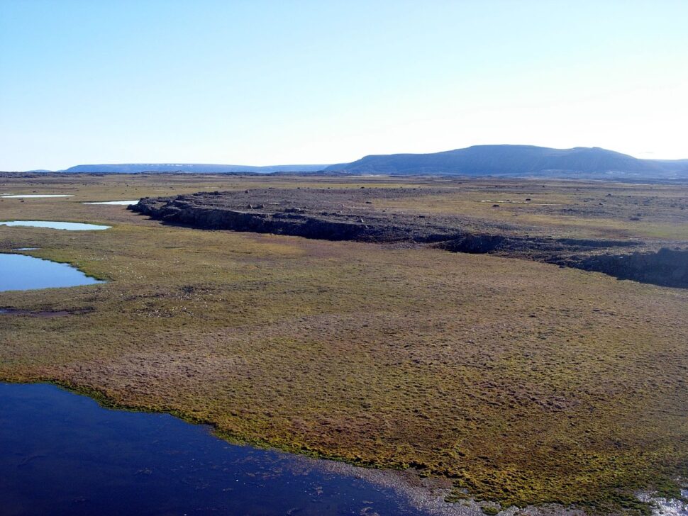
As the largest of the Parry Islands, in Nunavut, Canada, Devon Island is about 320 miles long and covered in an ice-covered plateau. Discovered by William Baffin in 1616, it was formerly named North Devon. Classified as a polar desert, barren mountains, frost-worn beaches, seabirds filling the skies and the occasional muskox wander along the shore. Devon Island is uninhabited. However, people have tried and failed for centuries to call it home. With the last settlement occurring in 1951, it sits alongside a military ghost town and a NASA research station perched at the edge of a massive crater.
Historians will recall the Lost Franklin Expedition. In 1845, 129 men on the HMS Erebus and HMS Terror set out to map the fabled Northwest Passage for Great Britain. Explorer findings included a piece of canvas marked “Terror”; 700 empty, lead-lined meat tins; and dozens of clothes, rope and pipes.

In 1852, Sir Edward Belcher attempted to find the missing men. Staying on Devon Island, the team lined a small bay with survey and marker cairns on the Port Refuge National Historic Site. The men were not found, but his HMS Resolute ship’s timber was responsible for building one of the world’s most iconic pieces of furniture — the Resolute Desk, still used by U.S. presidents today.
victoriaspics
Moai at Easter Island
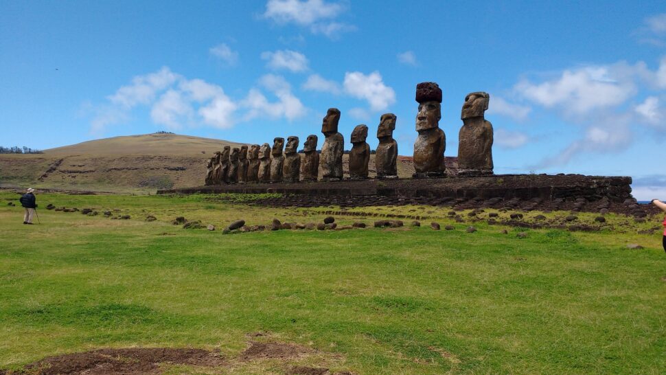
Easter Island, located in the southeast Pacific over 1,000 miles from the other islands of Eastern Polynesia, is one of the most remote inhabited places in the world. Between 600 A.D. and 800 A.D., a group of Eastern Polynesian colonists settled on Easter Island after sailing in a southeasterly direction. The name Easter Island originated with the European explorer Jacob Roggeveen, who first saw the island on Easter Sunday in 1722. Nowadays, the Easter Islanders call themselves and their homeland Rapa Nui. The art of Easter Island is distinctively Polynesian, largely centered on religious images. The most popular artwork is the stone figures, or moai, images of ancestral chiefs whose supernatural power protected the community. Between roughly 1100 and 1650, Rapa Nui carvers created about 900 sculptures.
The population density is 35 residents per .38 square miles, totaling about 7,750 residents calculated from the 2017 Census. Majority of its inhabitants (95%) live in Hanga Roa with a total of 7,322 residents, a blend of native islanders and residents of the Chilean mainland. The rest of the island’s residents are either of European (primarily Spanish) descent or of mixed European and native Chilean Indian descent.
The Changtang
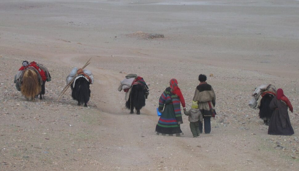
Nicknamed the “Roof of the World,” the Changtang, located on the Tibetan Plateau soars about four miles above sea level. At one of the highest points on Earth, it is extremely cold with Arctic-like winters. Summers are warm but short, with sudden thunderstorms and hailstorms. The region includes vast highlands and giant lakes, and wildlife is plentiful. Made up of nomads (called Changpa), they share their territory with chiru, snow leopards, kiang, brown bears, black-necked cranes and wild yaks. Most of the land is protected under the Changtang Nature Reserve, the second-largest terrestrial nature reserve in the world.
Because the land is not suitable for farming, nomads depend on their livestock to survive. They also move in established routes throughout the year, allowing the wealthy to have more permanent corrals and buildings in some encampments. Their pasture land is covered with Naza grass, which is very high in protein and enjoyable for sheep and yak. In August of each year, during the Nagqu Horse Racing Festival, festivities bring locals together for horsemanship, a Gorchom circle dance and a fashion show of Changtang costumes.
Deciding Whether To Visit Remote Islands or Not
While these seven remote locations above have varying stages of socialization, travelers who may be interested in exploring these areas should first check for travel safety instructions and whether they’re permitted to live (or visit) there at all. Once that’s established, learn how to exit as quickly as arriving. Without regular flights, public transportation and way less people to count on for help if lost, knowing how to move around while there is extremely important. If there will be language barriers, travel with helpful vacation partners or make sure to know enough words to communicate if/when running into locals. Safe travels!
